Strengthening Communities By Improving Mobility

Design Issues

broomfield town square

Mobility (noun): the ability to move or be moved freely and easily.

There are many modern forms of mobility including cars, bikes, scooters, buses, taxis, trains, planes, and more, not to mention a person’s own two feet. But “freely and easily” isn’t always the case when roads are clogged, destinations are distant, or infrastructure lags—or as population grows. In just one year, from 2020 to 2021, Colorado added approximately 100,000 residents with a growth rate about four times that of the United States. When it doesn’t feel easy to get around, people feel disconnected. Whole communities feel disconnected, and eventually deteriorate.

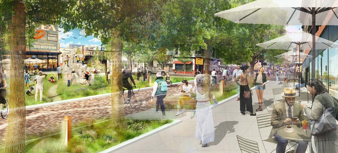
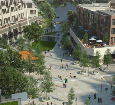
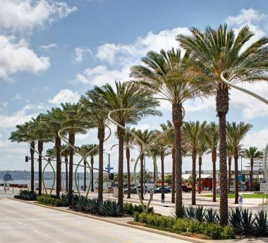
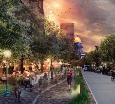
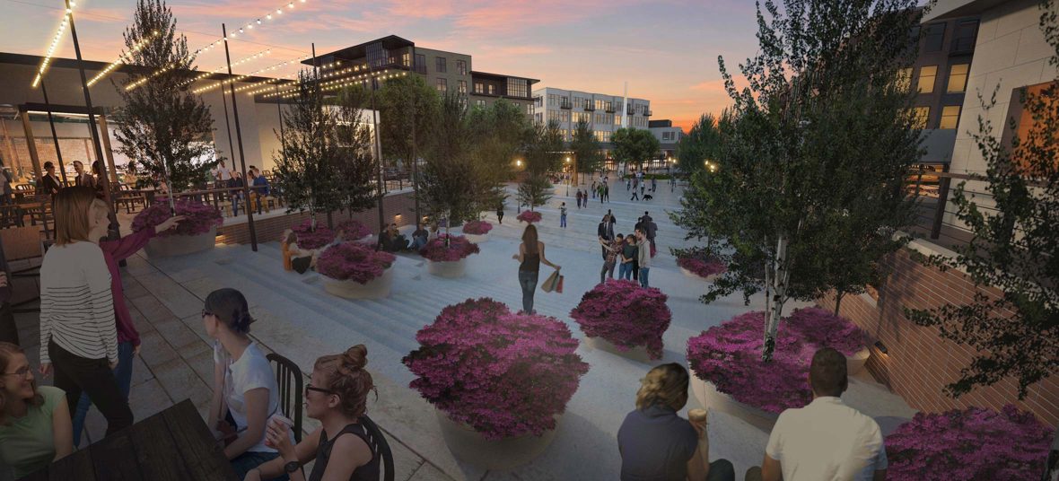
At Civitas, we are motivated to address population growth with smarter density that focuses on transit, enhanced pedestrian experiences, and robust park systems.

We believe this balanced approach to planning and design leads to a better quality of life, improving the health and wellbeing of individual people and whole communities. By asking questions, listening to a community’s longings and understanding the issues, we can improve accessibility, connectivity and comfort for all the various ways that people get around.

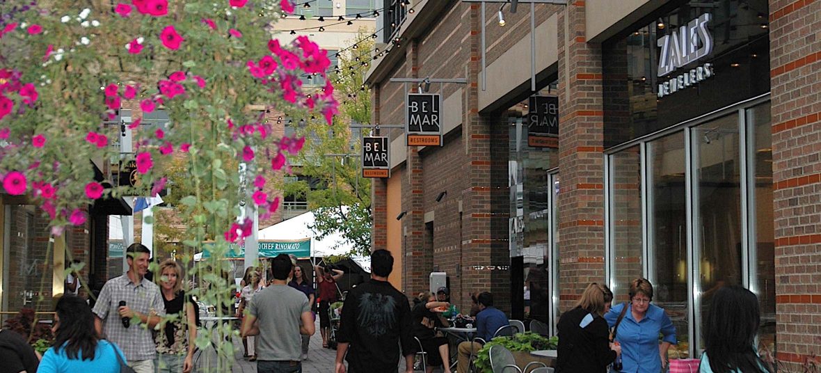
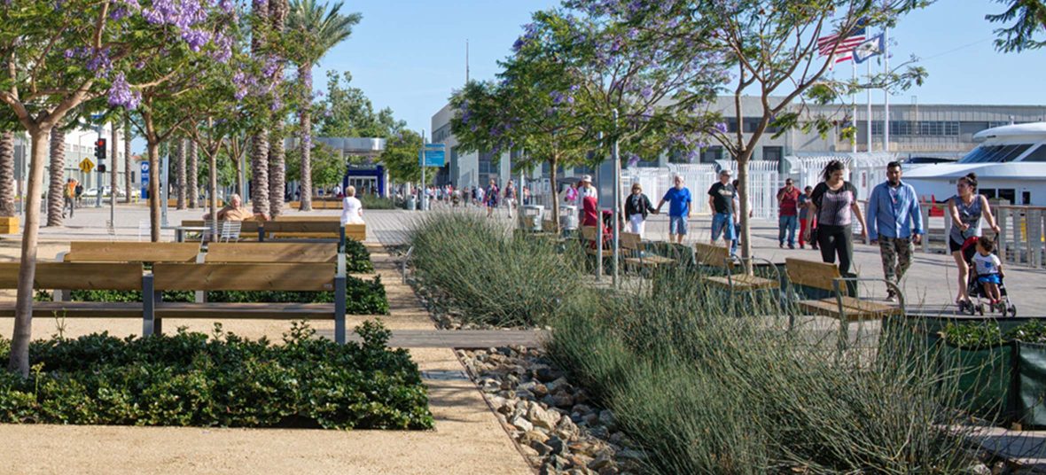
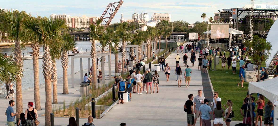
Here are recent examples of our efforts to tackle the issue of mobility with a variety of the ways people move:

Public Transit

In the Denver suburb of Broomfield, a new central plaza will become the focal point for a future mixed-use development that includes a library, hotel, central market and coworking space that are all walkable from existing residential neighborhoods and public transit. Broomfield has long been a bedroom community with many residents commuting into Denver via RTD trains, so transit connections are important. Creating a pedestrian-oriented public realm with a variety of civic spaces—including a new lake used for recreation and stormwater management—also ensures that Broomfield becomes a destination of its own, too.

broomfield town square

About two hours south in Pueblo, Colorado, we’re partnering with NeighborWorks Southern Colorado to envision and plan Pikes Peak Park, a new neighborhood offering a variety of housing types and price points to promote social and economic diversity. Amenities place an emphasis on community services such as childcare, healthcare and healthy food options, building a stable foundation upon which the community can grow. Connecting residents to jobs is a critical part of this stable foundation, so existing bus routes have been extended to and through the site. Easy-to-use bicycle facilities are also proposed, linking the neighborhood to existing regional trails, schools, community centers, healthcare facilities and employment centers.

Bicycles

The 5280 Trail, looping through downtown Denver, is similarly envisioned to connect people with the amenities and resources the city has to offer, becoming an economic engine by linking people with jobs, recreation and commerce, while also promoting health by getting people outside and moving. But in its form, it’s unique: A 5.280-mile loop that connects six distinct downtown neighborhoods, The 5280 Trail reimagines underutilized streets as an integrated system of urban spaces, places and trails that can be explored by foot or bike, creating new perspectives of the city.

The 5280 Trail will no doubt be used by people walking, jogging or biking to work, though its sole purpose is not to serve as a high-speed fitness or commuter route. As Chris Parezo wrote, “it’s designed to be safe, accessible and welcoming to all. Families out for a stroll. Parents pushing strollers and pulling wagons. People walking dogs. Friends and neighbors gathering.”

5280 trail

Pedestrian Access

As a car-free loop ranging from 10’-24’ wide in various sections, the design of the 5280 Trail, described by Jason Newsome, is “inspired by Colorado’s outdoor lifestyle and by the mountain trail mentality that is so present here.” To encourage people to get out and explore, a system of cairns, trailhead markers and signage guides people along the urban trail, often indicating right-of-way for bikes and pedestrians. The pattern of pavers is consistent throughout the loop, but intentionally varied colors and finishes emphasize critical decision points along the path and minimize safety concerns where different modes of transit (including cars) might come together.

The trail also forms new neighborhood centers and gathering places through the use of unique, neighborhood-specific design elements, ultimately celebrating and connecting all six of the neighborhoods together—creating proximities that aren’t otherwise so easily apparent. As Chris Parezo. put it, the trail “makes Denver feel a little smaller and more intimate, and you immediately understand why connection can be so powerful.”

belmar urban design

For Belmar Town Center, in the Denver suburb of Lakewood, connectivity means giving a community a long-needed central town center. An aging 1950s mall known as Villa Italia was mostly empty by the 2000s, yet occupied a prime 100-acre site in Lakewood. Collaborating with Elkus Manfredi Architects and the developer, Continuum Partners, we worked to transform the site into a new grid of 22 city blocks that encourage pedestrian circulation and community gatherings, and activate the public realm. Nine acres of urban parks and plazas, including a pedestrian-only, car-free plaza at the heart of the project create a town center for a community that didn’t otherwise have one. Lead designer Craig Vickers said of Belmar, “the community now has a true center that continues to grow organically as a city should, based upon the framework that we put in place. Everything is within a 10-minute walk. People can put down roots and feel proud of where they live.” In 2018, Civitas received an Honor Award for Excellence in Designing Healthy 10-Minute Neighborhoods from the International Making Cities Livable Conference for our work at Belmar.

Parking

Our goals often prioritize the pedestrian experience and parks, yet we can’t abandon cars completely. In fact, our goal is typically to ease their movement too, since the presence of cars often impacts most other modes of getting around. At Twin Silo Park in Ft. Collins, Colorado—a 54-acre city park that playfully celebrates the community’s agricultural roots—we pushed vehicular parking inward so that the park’s visible perimeter could show off the native grasses and other natural landscape features.

We took a similar approach to comfortably accommodate yet deemphasize cars in a design scheme proposed for Balboa Park in San Diego, California. Our plan reroutes cars around the core of the park, features an underground garage with 800 parking spaces, and restores the historic Plaza de Panama and other spaces back into free and open parkland. Existing roadways are proposed to be converted into pedestrian-oriented zones that accommodate park shuttles and maintenance vehicles but otherwise remain car-free. The project creates 6.3 acres of new parkland, reclaimed from cars and asphalt.

north embarcadero

Along the coast in San Diego, our work along the Embarcadero (some completed, some proposed) reclaims 13-acres of parking to create a vibrant, pedestrian friendly and sustainable public space along a mile-long stretch of San Diego’s waterfront. The new North Embarcadero reduces the width of Harbor Drive to create a 105’-wide continuous public esplanade; adds green space between the road and the water; creates dedicated lanes for alternative transit; and improves pedestrian accessibility. Parking can be relocated to nearby mobility hubs that integrate parking with mass transit, ridesharing, bikes, scooters and electric vehicle charging.

Roads and Highways

Across the country in Tampa, Florida, we have also worked to restore a waterfront while improving connections between people and the water. Here, an historic Black neighborhood—Tampa’s Roberts City neighborhood—had been razed when Interstate 275 was developed in the 1960s. Instead of improving connections, as the highways were intended, important community connections had been severed. Fast forward through decades of distrust, disintegration and decline, and finally the new-and-improved Julian B. Lane Waterfront Park has given a deserving community both a connection to the river, and a source of pride, recreation, relaxation and health. The park doesn’t eliminate the highway, but demonstrates that highways and park systems can work together.

promenade

Closer to home in Denver, we’re involved in the Central 70 Project that repurposes a highway and creates a park amenity. As the Colorado Department of Transportation explains, the project “will reconstruct a 10-mile stretch of I-70, add one new express lane in each direction, remove an aging 57-year old viaduct, lower a section of the interstate, and place a 4-acre park over a portion of the lowered interstate.” While the highway itself improves mobility for cars by easing traffic flow, this cover park will feature programmable fields for recreation and public events, play spaces, and improved connections between neighborhoods previously separated by the highway.

Mobility-Challenged

While many cities are actively working to reconfigure industrialized parts of their towns into parks, Black Bay Park in Post Falls, Idaho, is already a natural oasis of 60 acres along the Spokane River. Here, mobility took on an important meaning for us: equity and accessibility. Our overall goal was to create a nature-in-the-city experience, and to help raise awareness of this wonderful natural asset by elevating the experiences within it. During our public engagement process, one of the more impactful conversations involved a community member who has limited mobility and uses a wheelchair. During our initial conversation she expressed her most basic desire was to experience the park, its amenities and the river with her child, not simply watching her child, much like the way other parents could. This personal story inspired us to provide an improved circulation system that follows the park’s natural topography—including over 100’ of grade change—with looping trail patterns that minimize disturbance while allowing users of all mobility levels to explore the entire park.

Improved physical connections—whether that’s through improved circulation and movement for cars, bikes, or people—can boost emotional connections, and improve a person’s sense of purpose, pride and belonging. And this leads to another definition of mobility: the ability to move easily from one place, social class or job to another. Connected communities are strong, sustainable, resilient places that grow and thrive, and that help individual people grow and thrive. And that’s exactly where we want to be.

black bay park